
|

1970 Soil Survey
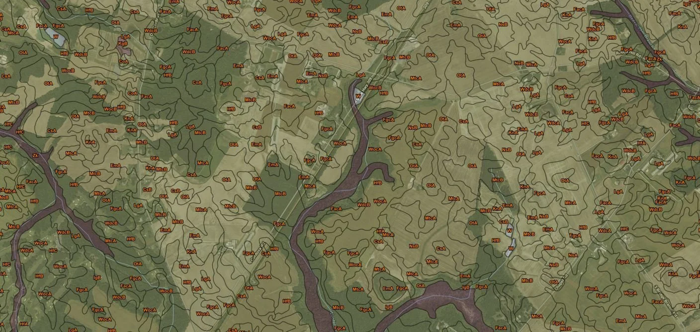
The original Talbot County Soil Survey, completed in 1970, provided foundational soil information that could be used for a wide range of planning and land-management decisions. It supported practical applications such as managing farms and woodland, selecting suitable sites for roads, ponds, buildings, and other structures, and evaluating land capability for uses like agriculture, industry, and recreation. The survey included detailed soil maps, with individual soil areas clearly outlined and identified by map symbols, allowing users to match a location on the landscape to the corresponding soil description and limitations. A copy of this 1970 survey remains available in our office for public viewing.
In 2008, an updated Talbot County soil survey was completed using a modernized soil classification and naming system, along with updated mapping and interpretations. This newer survey is readily available online through the USDA’s Web Soil Survey (WSS). Using WSS, users can draw an Area of Interest (AOI) anywhere in Talbot County and generate site-specific soil reports, including soil properties, ratings, and interpretations for common planning needs—such as building site development, septic suitability, drainage and hydric soils, crop productivity, erosion risk, and conservation planning considerations. This online tool makes it easy to access current soil information and print customized reports for projects, permitting, or land-use decisions.

Annie Rossi and Jim Brewer, NRCS Soil Scientists
Contact:
Annie Rossi, Ph. D., CPSS
NRCS Soil Scientist
443-746-4313
James Brewer, CPSS/SCC
NRCS Resource Soil Scientist
443-746-4319
|
|
To learn more, visit https://www.nrcs.usda.gov/wps/portal/nrcs/detail/md/home/?cid=NRCSEPRD1426845